Wildlife Tech Class of 2021
Carmel High School
Mentor: Chris Nagy (MRG)

Project: Urban Coyote (Canis latrans) Habitation on Long Island and its Implications
Project Status: Completed
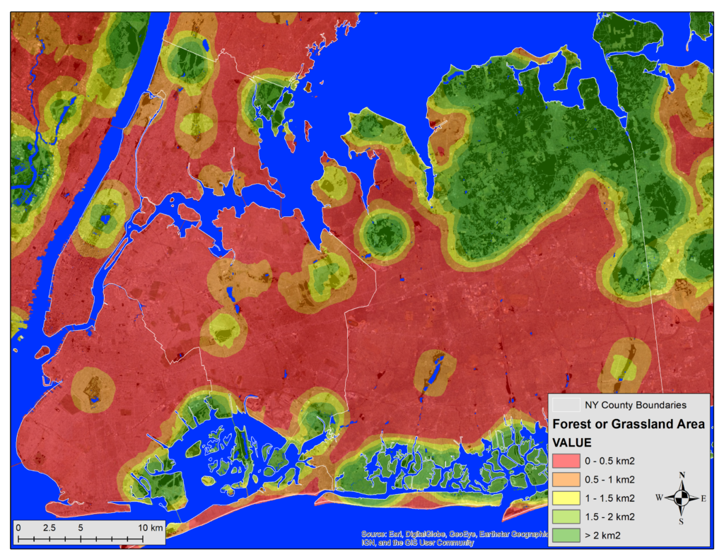
Project Description: This study explored the habitat size requirements of urban Canis latrans (Coyote) and possible habitation sites. Previous data regarding land cover use, maximum habit size, and urban Coyote sites were used. A moving window test was performed in the computer program ArcGIS using the National Land Cover Database’s information for forest and grassland as that was what Coyotes were found to use most. A moving window test was performed to see how much forest and grassland was in a 14km2 area. This measurement was used as it was found to be the farthest a Coyote traveled to obtain the necessary materials in their home range. A heat map was then created of forest and grassland measured, focusing on the Long Island region. The more forest and grassland in an area, the more likely it is to be habituated by Coyotes. Then, all sites (8) where Coyotes were found were measured for forest and grassland and classified based on Coyote breeding. The average was taken of all breeding sites and all non-breeding sites. The averages were then compared to the heat map locations. In conclusion, both hypotheses were supported: Coyotes can live in a wide spectrum of conditions and patch sizes and sites where Coyotes were directly observed scored higher on the model. The information from this study provides potential sites Coyotes may inhabit in the future and allows people to be more aware of where Coyotes inhabit to ensure the safety of the community, the pets of the residents, and the Coyotes. This study also allows scientists to know where Coyotes are most likely to be seen and guides researchers to places where camera traps will be most effective in spotting Coyotes.

